Goat Trail Norumbega Mountain
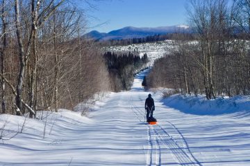
On February 17th, Frosty and I headed to Mount Desert Island to hike in Acadia National Park. We parked off Route 3 in the Norumbega Mountain . When we arrived at the trailhead, the temperature was 21 degrees.

I Made It up This Section of the Goat Trail on Norumbega Mountain
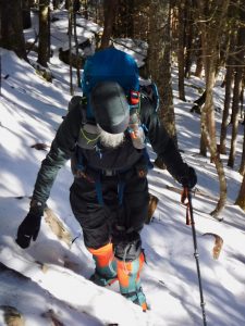
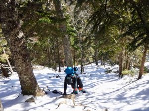
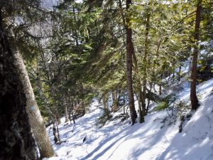
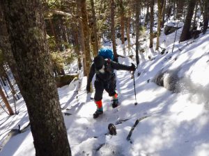
Our original plan was to hike a loop on Norumbega Mountain. We went up the Goat Trail. The day before there had been freezing rain and a wintery mix. No one had been up the trail since then. There was a crust of ice on top of the snow.
Goat Trail Norumbega Mountain
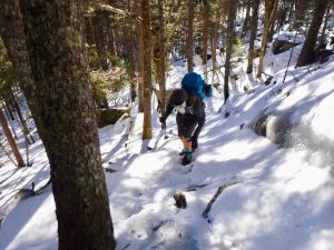
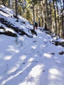
Frosty and I had on microspikes and made it up some very steep, icy pitches. I was feeling good… then I hit a wall. Frosty had made it up this short section of thick ice that stopped me. I couldn’t stick my spikes in the right way. I kept digging my toes into the ice, but I needed to get the side of my foot dug in, since my toe spikes weren’t aggressive enough for what I was trying to do.
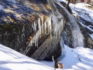
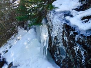
Icicles Hang From a Rock on the Goat Trail Norumbega Mountain
I could’ve been more successful with different gear, crampons and/or using an ice ax to pull myself up. Or… if I had more courage/less fear. Definitely, part of the problem was my fear of falling.

Frosty on the Goat Trail
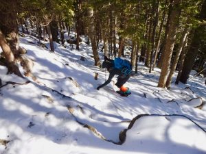
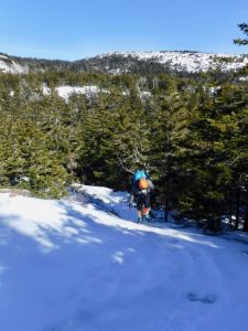
I had gone from feeling successful, getting myself up a small icy chimney like section to feeling defeated in the space of 15 feet of trail. I think this was the last major pitch, so I had almost made it. But not being sure, we turned around. There was lots of butt sledding on the descent for me, not Frosty.
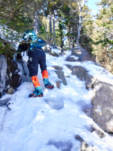
Frosty Coming Back Down the Section I Couldn’t Get Up. It Was Steeper and Icier Than It Looks
Okay… so what now? It was too early to stop adventuring for the day.
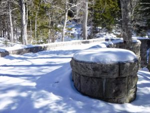
Bridge on the Carriage Road Near Hadlock Falls
We decided to hike to Cedar Swamp Mountain which we missed on our Sargent hike the other day. We went back to the parking lot, crossed Route 3, and headed onto the trails on that side. I would list all the trail names, but many times in Acadia I’m not really sure of names. From the parking lot to the carriage road, I’m not sure of the trail name(s). From the carriage road, we went up the Hadlock Brook trail adjacent to Hadlock Falls.
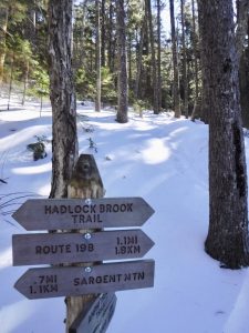
The Bottom Signs on this Post Point to the Amphitheater Trail
From our direction, Cedar Swamp Mountain wasn’t listed on any of the trail signs. I decided to call the mountain Dirty Sock Mountain, in an attempt to find an even less appealing name for it.

Birch Spring is Just Beyond This Trail Sign at the Junction of the Amphitheater Trail and the Sargent South Ridge Trail
After summiting Sargent Mountain the other day, we had wanted to summit CSM. But we weren’t sure of the way. It wasn’t listed on any of the signs we passed. We had come to one junction on the trail that we suspected might have been the path we needed to take, but weren’t sure. In the end, we didn’t take it. This trail (the Amphitheater Trail) was indeed the one that we should have taken. It connects to the Sargent South Ridge trail passing by Birch Spring. The Cedar Swamp summit is accessed from a short spur trail off the Sargent South Ridge trail. The summit trail is marked.
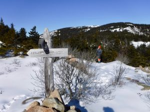
Frosty on the Sargent South Ridge Trail Approaching the Spur Trail for Cedar Swamp Mountain
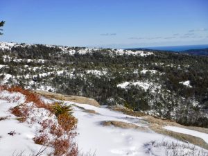
When we popped up above tree line the wind was whipping. Frosty got out his anemometer. He measured sustained winds at 22 miles per hour and gusts of 25 mph. The sun was incredible and the air temperature was fine for hiking, but the wind was uncomfortable. Most of this hike was going to be sheltered which was another reason it was a good choice for today.

Frosty Checking the Wind Speed as His Overmitt Was Whipping in the Wind on the Summit of Cedar Swamp Mountain
Great views of Sargent and Penobscot Mountains from CSM.

View of Penobscot Mountain from Dirty Sock (Cedar Swamp Mountain)
We went down the Sargent South Ridge trail to a carriage road. When we neared Upper Hadlock Pond, we bushwhacked down to the pond and followed a trail that skirts the edge of the pond for awhile. Then back to the parking lot.
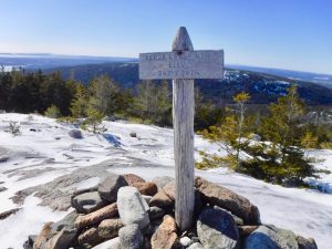
Summit Sign for Cedar Swamp Mountain
My Garmin said our total milage was 6.16 miles. A mile of that was on the Norumbega Goat Trail, a half mile up and a half mile down. A significant portion of the mileage was easy walking on carriage roads.

Descending Cedar Swamp Mountain Looking Back on a Cairn
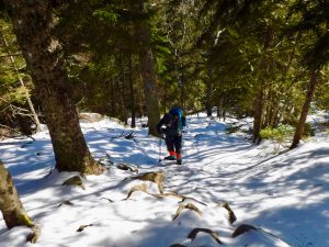
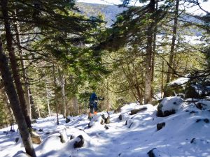
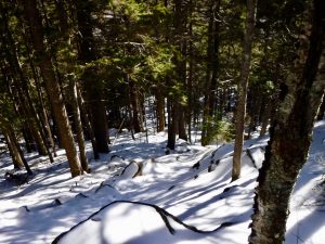
Below are some additional photos from our day. I took quite a few of the Goat Trail; loving how steep is was. Unfortunately, I couldn’t capture the steepness in the photos.

Goat Trail Norumbega Mountain
Goat Trail Norumbega Mountain
Goat Trail Norumbega Mountain
Ice Covered Rock Goat Trail Norumbega Mountain
Goat Trail Norumbega Mountain
Goat Trail Norumbega Mountain

Sargent South Ridge Trail South of Cedar Swamp Mountain Summit
Penobscot Mountain from Cedar Swamp Mountain

Goat Trail Norumbega Mountain
Goat Trail Norumbega Mountain
Goat Trail Norumbega Mountain
Sargent Mountain South Ridge Trail North of Cedar Swamp Mountain Summit
Goat Trail Norumbega Mountain
Goat Trail Norumbega Mountain
Goat Trail Norumbega Mountain