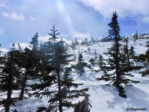
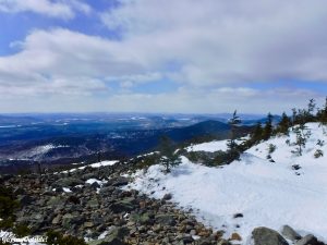
The View from White Cap Mountain
On Sunday, March 17th, Frosty and I woke up early to head to White Cap Mountain. There are three White Cap Mountains in Maine. We were hiking the one in the 100 Mile Wilderness. This mountain is one of the six mountains in the Moosehead Pinnacle Pursuit (MPP). In addition to the regular MPP, there is also an ultra, winter and winter ultra. Frosty and I were hiking White Cap as part of the winter challenge for MPP.
The View from White Cap Mountain
We had planned to do this scouting/summit attempt hike on Saturday. The weather forecast for Saturday was glorious. Sun, temperatures above freezing, and low wind conditions at the summit. That great forecast though, creates other problems for those hiking in the winter. With the warmth, we would be sinking deep in the melting snow. We decided to wait until Sunday when the temperatures were to dip back down below freezing.
We Drove in on a Road That Resembled an Ice Rink
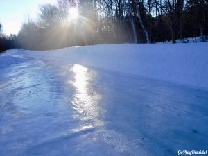
We drove down the Frenchtown Road as far as possible. The county stops plowing at the border of the South Inlet Wilderness Campground. The road is plowed privately beyond this point. From where the county stops plowing to the end of the plowed part of the road was pure ice, probably from yesterday’s warm temperatures. We slipped and slid a little. I’m not sure how we managed as well as we did.
Frosty Chaining up the Adventure Mobile
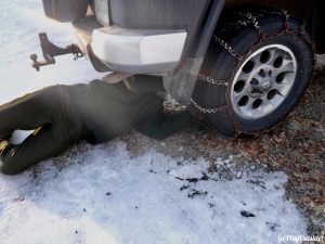
When we parked, Frosty put the chains on before we headed out for our adventure. Between the icy road and chaining up, we ended up starting out an hour later than planned.
A Bridge Crossing
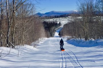
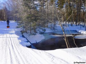
We had to ski 3.45 miles one way to get to the trail we were taking. Frosty hauled our packs in a sled. We skied over a few bridges. The way the snow mounds around little open streams is so cool. In one area that we skied past, there was a cedar tree that moose had been munching on. There were piles of moose droppings all around this section.
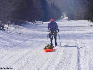
Frosty Pulled Our Gear in a Sled
We skied to the area near the gate where we parked last summer to hike White Cap. I’m not sure if the gate was open or just under the snow. All I could see were the gate posts. We had a drink and topped off our water bottles with the extra water Frosty had put in the sled. We stashed the sled and skis here, and changed into our snowshoes.
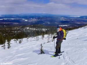
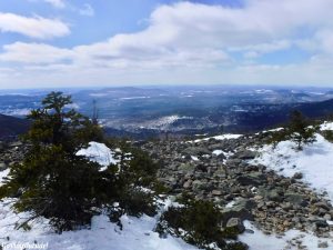
The View from Above Tree Line
Frosty had studied satellite images of White Cap. He found two old tote roads that we could take up. With a short bushwhack, we ended up on the Appalachian Trail going up White Cap. This cut a mile total off our distance for the day. It also bypassed the steep section at the beginning of the White Cap trail.
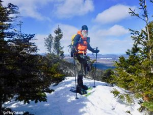
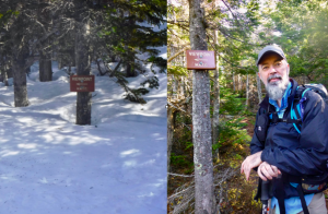
At the Viewpoint
When Frosty studied the satellite images, he found the areas where the roads and trail were the closest to cross over. He selected areas with hardwoods to make the crossings easier. We had some tree dodging to do, but this area was relatively open.
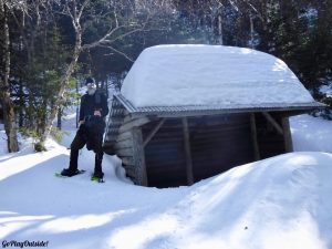
Frosty at the Logan Brook Shelter… Check out That Snow!
We joined the AT on the flatter section leading up to the Logan Brook shelter. When we arrived at the shelter, we stopped for a snack and drinks. I couldn’t believe the amount of snow on the shelter! The signs that are usually at head height were near our ankles.
Holy Snow!
Inside, the shelter was protected and free from snow. Frosty and I had thought that we might have to plan a two day trip to climb White Cap this winter. We were going to stay at the shelter, if we did that. We were lucky to get this hike done in one day.
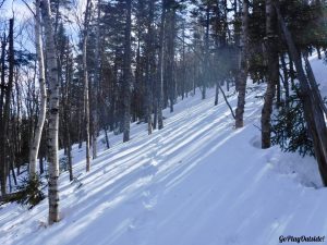
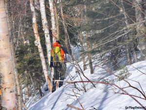
Heading up After the Logan Brook Shelter
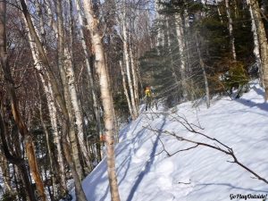
After the shelter, the trail was steep, but still open. Once we turned at the double blaze, the trail had a lot of long stretches where we had to fight tree branches. With all the snow, we were traveling above where the trail is cut for people. Fighting through the trees was the worst part. It was a battle, and I had the bruises to prove it.
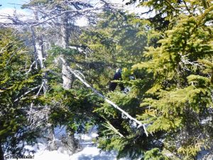
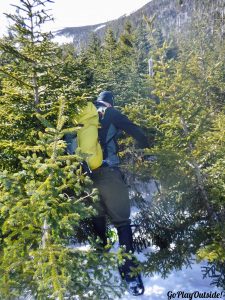
Yes… This IS the Trail! can You Spot Frosty? He’s a Few Steps in front of me.
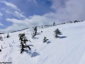
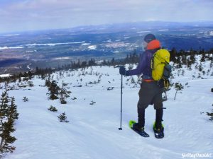
When we made it to the tree line, we were so relieved! No more trees attacking us! The wind could be felt today, even in the woods, where often hikers are sheltered from it. Above tree line though, the wind was really whipping! It wasn’t pleasant, but it was much better than fighting the trees. I also know the wind could have been much worse.
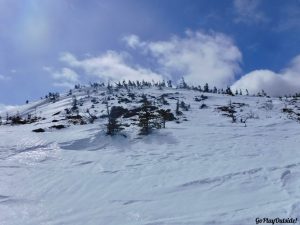
Finally Above Tree Line
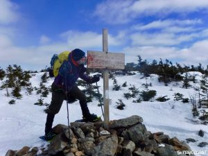
There were very few visible cairns or blazes to lead us to the summit sign. We just headed up. Eventually, we saw the white pipes near the summit. Since we have climbed White Cap the last two years, we now knew where to head and found the summit sign.
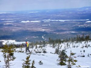
Frosty Heading to the Summit
Yeah! We were so happy to have made it! Neither of us wanted to ski in again or fight the trees to make a second attempt. Frosty was so happy that he kissed the sign!
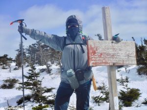
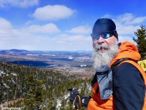
Frosty Was Happy to Reach the Summit and Complete the Winter Moosshead Pinnacle Pursuit
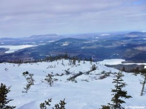
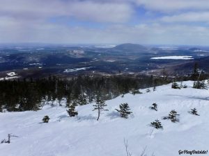
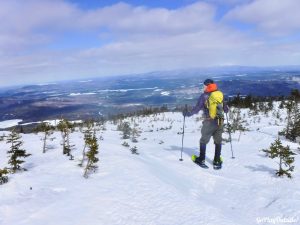
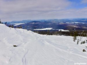
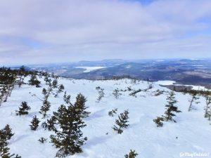
We could see Katahdin, with clouds just barely crowning its head, in the distance. The sun was shining. The sky was clear and blue, and the views were great.
Magoo at the Summit of White Cap Mountain
The trip back through the trees was still annoying. It was slightly faster than on our way up, since we weren’t trail finding. We just followed our previous tracks. After we fought our way back through the attacking trees, the descent was relatively fast. The walk next to the ravine, after the shelter, was scenic.
Frosty on White Cap Mountain
As we hoped, the snow conditions were perfect for our trip. Saturday’s warm temperatures had compacted the snow. Then, it froze back up overnight. The snow was firm. We had very little sinking, three inches or less in most places. Half of our MPP hikes this winter have had a lot of sinking in powder that hasn’t condensed. That was the case for Number Four, Eagle Rock, and Big Moose.
Above Tree Line on White Cap Mountain
Once we were back at the place where we left the skis, I was ready to be done. It’s like the adventure part is over, and then you just have a long, slog back to the vehicle. There were a few good views along the way, but mostly I was focusing on finishing! Then, we had to skate our vehicle back down the road rink. We moved slowly with the chains on. This seemed to take forever! I was so glad once we left the icy section of the road.
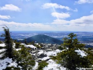
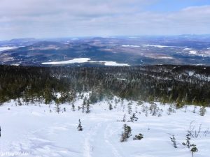
View from the Summit of White Cap Mountain in the 100 Mile Wilderness
Click the link for Frosty’s gear list.
Snowshoeing Along the Ravine
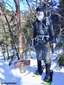
Same Sign… Different Trips
Looking up Toward the Summit
Steep Feet
Heading into the Trees Again
At the Viewpoint
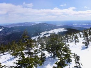
View from the Summit of White Cap Mountain in the 100 Mile Wilderness
View from the Summit of White Cap Mountain in the 100 Mile Wilderness
View from the Summit of White Cap Mountain in the 100 Mile Wilderness
Frosty Heading Down
Snowmobile Tracks
The View from White Cap Mountain
View from White Cap Mountain
Frosty Enjoyed the View on White Cap Mountain